Yesterday’s post sparked a memory about Death Valley …
My late father-in-law, Ivan, loved to tell us about traveling across Death Valley to visit relatives, stationed on an Army base in California. He was born in 1910, so that might have been in the early ’20s. At that time, there apparently were no proper roads across the valley, but folks had discovered they could cut off a few hours’ time traveling southwest if they braved the Mojave Desert on their way to the coast.
So enterprising engineers devised a makeshift “road” of two narrow wooden slats over the sand, and Ivan’s family drove their Model T carefully on the boards, taking care not slip off one side or the other (talk about driving attentively!). And since a slip or a breakdown in the Mojave Desert’s extreme temperatures could be fatal, mounted men regularly patrolled the route (early highway patrolmen?).
Death Valley is located on the border between southeastern California and Nevada and covers a 3,000-square-mile area. It’s the lowest, driest, and hottest area in North America. (It’s also bordered by Mount Whitney, the highest point in the contiguous U.S.). Consequently, it’s set lots of records: the highest recorded temperature on Earth (134°F), the greatest number of consecutive days over 100°F (154), the hottest daily low temperature ever recorded (107°F), the hottest 24-hour average temperature (117.5°F), and even the hottest overnight low (107°F). Not a place you’d want to get stranded.
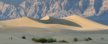
Photo by Tuxyso via Wikimedia Commons
Today, California SR 190 travels through Death Valley, following the gold-rush path of 1849. A man named Herman Eichbaum was instrumental in creating a toll road through the valley in 1926, bringing tourism to the area. But I couldn’t find information about either the primitive wooden-slat route my father-in-law talked about or the early highway patrolmen. Maybe a similar story has been passed down in your family? Tell all!
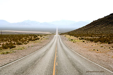
Photo by Jon Rawlinson via Wikimedia Commons


